
Blogged Images


Found a soarable hill in flat Ipswich!
Nasa data set processed through AWK and MySQL to generate Google Earth placemarks file
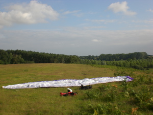
The sport of Paragliding has been a real joy for me over the past year. It's seen me flying a foot-launched portable aircraft in New Hampshire, Tenerife, the Alps, and most recently, Norfolk!. In October 2007 I'll be making a trip to the Pyrenees to continue my flying career. It's great to get out and about in this way, but it's a sign of a fundamental UNDERLYING PROBLEM.
Paragliding requires hills, or preferably mountains, to generate dynamic lift, and to assist in the generation of thermals for cross country. Where I live in the UK (Ipswich) and the US (Boston), there are no bloody hills at all.
Suffolk Hills and Hens Teeth, Needles and Haystacks
People who know me will probably realise what's coming. Not to be daunted by the mere geology of the place I'm living, I set about trying to find hills in Ipswich. You only need a small sharp incline to be able to do soaring in dynamic lift when the wind is onto the slope. This is what the Norfolk club and other coastal clubs do on sea-cliffs. Below is some video I took on the first occasion I actually flew in flat Suffolk - at Corton, Lowestoft.
The Easterlies which make cliff soaring possible are rare, leaving you banking on a sea breeze which may or may not come on any given day. Basically what I ended up looking for is South Westerly or Westerly facing 'cliffs' inland which generate uplift when the prevailing wind blows onto them. Initially, to find hills I was trying to look for closely packed contour lines on local OS maps, but this quickly became frustrating, especially to someone who works with software and databases - you expect to be able to query this kind of stuff! So that became the challenge. Can you use modern open source technology and public data sets in order to find a flyable hill in Ipswich?
Writing Software for Finding Hills
I'd attempted this a few years ago when I was still learning about both paragliding and databases. I tried to use all kinds of free GIS software in order to search for the right kind of landscape features. It was painful, and unsuccessful. This time I was going to crack it!
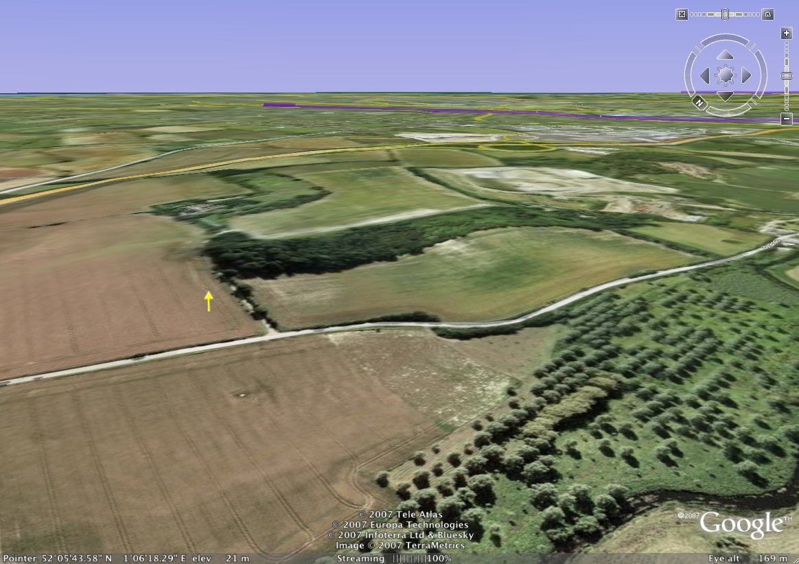
Finally I got hold of some NASA Shuttle scans of terrain elevation, processed it using AWK into a MySQL database and then queried and re-processed it in AWK to create a really convenient Google Earth file like those linked below, showing you the most significant inclines which facing a particular wind direction near Ipswich. You can read more about the techniques, data and tools on the project page if you want. In the meantime here are some actual, and possibly soarable (in the perfect conditions at least) hills which were found .
Download The Soaring Maps - By Wind Direction - Viewable in Google Earth
North Easterly Ipswich-centred map shown left. NE file includes N through NE through E. Download Google Earth here for free. Ask me for other maps.
Downloads...
North, North East, East, South East, South, South West, West, North West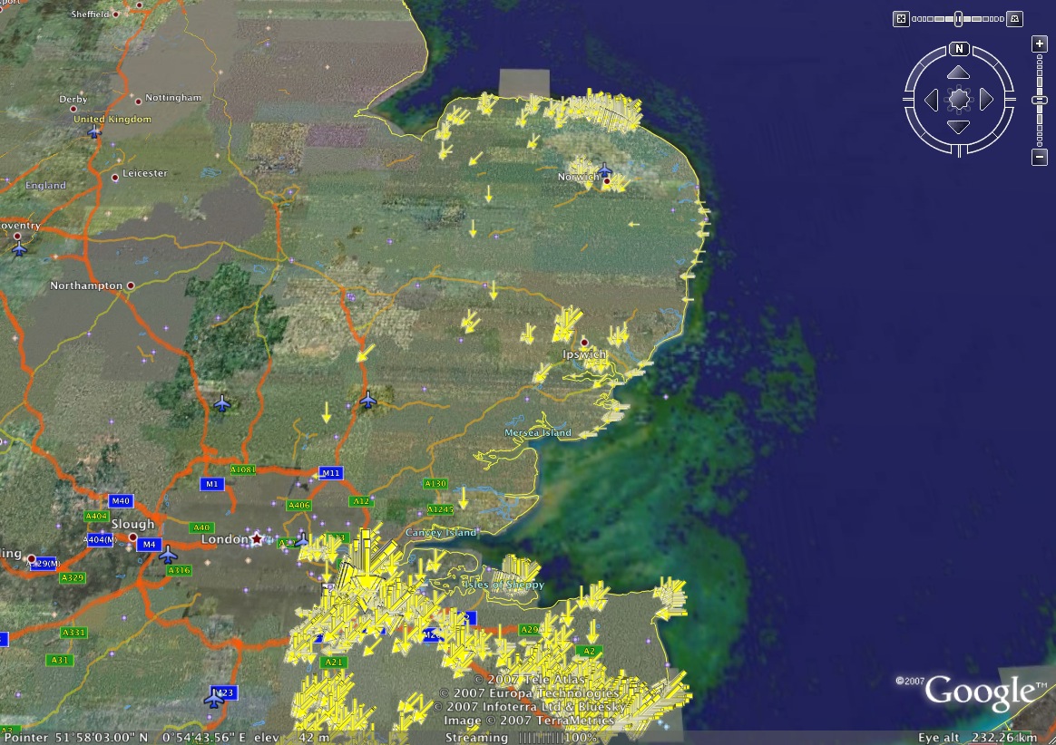
The areas which have promising geology are very obvious on the Google Earth view (revealing some very interesting looking ridges around Gillingham too, by coincidence. I found a bunch of interesting features, and went surveying them in person.
The Survey - Hills Found
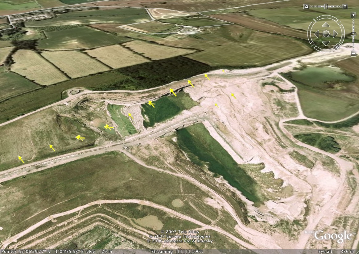
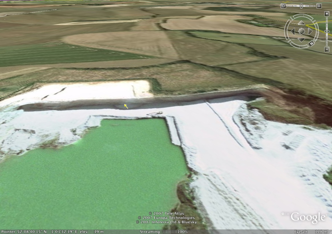
The Great Blakenham site is by far the largest single feature which was revealed near Ipswich, but is only suitable for Northerlies (not the typical prevailing wind). It also looks like there might be problems of rotor if you descend into the bowl and try to land at the bottom - top and slope landings only! They are planning to build a Ski Centre there, so it won't be available for long! When I visited this I grounded my car (a smart car) on the speed bumps, so didn't investigate further. I think it's been used for landfill so could be very smelly. There are other useful looking locations in quarries, such as the NNE cliff in a quarry at Needham, and the Westerly described in more detail below.
I'm wondering whether there may be some more minor features like banks and steps which are still soarable. Hence the importance of getting hold of the 25m resolution data set which can identify these smaller features.
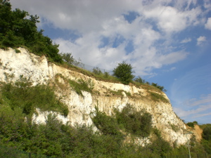
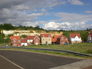
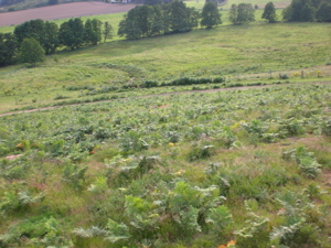
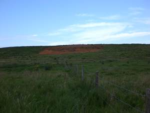
Once mapped into Google Earth I could zoom in and to inspect individual possible slopes on my laptop, then get Google to plan the survey routes for me. This turned out to be a lovely way to spend the summer anyway, visiting the only high points in the County of Suffolk, climbing the hills, and introducing yourself to the locals to find out how to get permission to fly there. The cliff pictures above are from a really promising quarry site at Claydon which was empty on Google maps' aerial view but when visiting in person turned out to have a new housing estate in it. Otherwise it would have been perfect - Westerly facing!
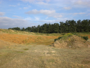
There does seem to be a systematic problem with the hills in Suffolk, though, leaving you scratching around for tiny slopes like this gravel pit. Even the ones which are in principle flyable frequently have bloody great power cables running across the front, or have been turned over to forestry, making a launch impossible. I think this is because Suffolk farmers aren't geared up for farming on hills, so they prefer to leave them fallow and loan them to the power companies. Where there are natural hill features, they have also often been mined out. These are then often used for landfill - not the most pleasant sites to fly (although the seagulls look like they enjoy themselves floating over the rubbish I must admit).

The Winner Is?
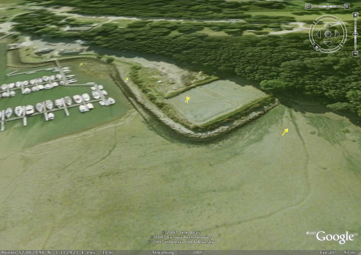
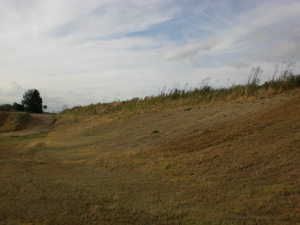
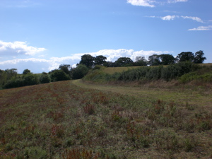
The most promising practice ridge for my purposes is shown above and below, but not described fully here, partly because I've been asked to keep it low key by the landowner who's given me permission to fly there. However I can tell you it's a Westerly to South-Westerly facing ridge which is not far from where I work - I can pop there for practice if I take a long lunch. It's even on a footpath!
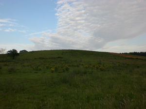
The sharpest ridge is about 7 metres high, a steep incline with a plain in front. The full height of the feature is about 15 metres or so - its suitable for a little dynamic lift.
If you're also a pilot and want to come and visit the site or help me survey the others, or just get the paragliding Google Map for your particular area like those linked in the download section above then get in touch.
Update 1
It turns out that the slope direction is also very important to thermalling cross country, so even where it's practically flat, my fellow pilots are interested to know the faces which are more solar-active than others and where the thermals will trigger from (normally the highest point) to plan their routes. Hopefully I can generate some nice maps for them to take up on their 40km cross country flights - probably generated in Google Earth.
Update 2
Got some interest from a Kent Paragliding club to create a gazetteer for the Easterly sites which they are missing. Sites officer I met in Algodonales, Spain is due to get in touch with me.
Update 3
Found an error which means that diagonal (NW, NE, SE, SW) hills are more likely to be detected than horizontal hills (N,E,S,W) on the map. This is because the data is on a grid, and so the diagonal corners need to be rescaled by a factor of sqrt(2).
Update 4
There's another Suffolk pilot up to the same thing - Adam Ladd sent me this link to a video of him flying a gravel pit near Bury St. Edmunds. Looks like he's going to join the Suffolk paragliding survey expedition to check out the things which have turned up on the Google Earth map!
Latest | Search | Contact