
| Area: | Yorkshire Dales | Ascent: | 1373 feet |
| Walk No: | 174 | Time: | 4 hours |
| Date: | 14th June 2008 | Parking: | Roadside near Hill Inn (SD745777) |
| Distance: | 7.25 miles | Weather: | Fine & Sunny to start then showery |
| Route: | Car - Braithwaite Wife Hole - Humphrey Bottom - Simon Fell - Souther Scales Fell - Park Fell - Gauber High Pasture - Car |
For those of you that are thinking of going onto the hills I would strongly recommend that you read the advice given by the Mountain Rescue organisation of England and Wales. To read this advice, which will open in a new page please click HERE. If you would like to make a donation to the Mountain Rescue organisation which is purely voluntary please click HERE. Please make the time to read the advice page.
I was by myself for this walk and so it was an early start which was just as well as the weather took a turn for the worse late in the walk. I've called this a "Nearly Ingleborough" walk as that was my original intention. I had planned to go up Ingleborough from the Hill Inn then drop down on the Crina Bottom path as far as Quaking Pot to take the path back round to Humphrey Bottom and back to the Hill Inn. However when I got as far as the bottom of Swine Tail I could see that there were lots of people on Ingleborough so decided instead to go to Simon Fell and over Souther Scales to Park Fell. From there I descended to Colt Park before taking a path over Gauber High Pasture back to the car. My change of plan was a good one.....on my revised route I saw not one person until I reached the road for the short walk back to the car.

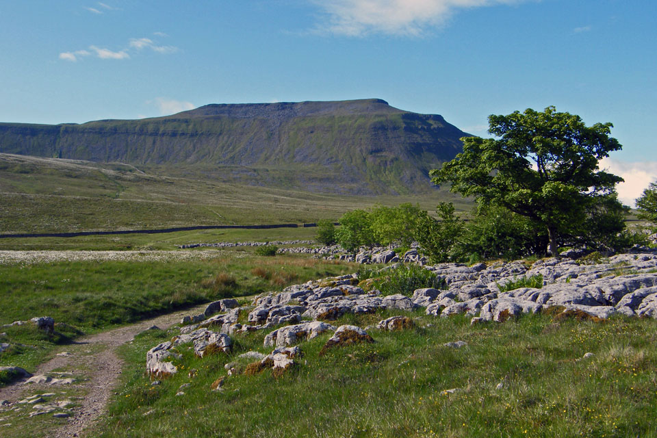
Ingleborough from where I parked the car.

And Whernside from the same place with the 3 Peaks path seen plainly in mid picture

The start of the path towards Ingleborough

Twisleton Scars across the valley. The darker fell to the far right is Gragareth

Whernside as I enter the nature reserve

Raven Scar (l) and Twisleton Scars (r)
Ingleborough as I approach Braithwaite Wife Hole

Braithwaite Wife Hole with Ingleborough behind

Whernside across the valley with lots of bog cotton in the foreground


Getting higher.


Not a very good picture but it shows the steeper part of the climb onto the ridge. From the top of this path the way to Ingleborough is to the right but as I reached the top I could see lots of people going up and down Swine Tail and made the decision to go elsewhere to find a little peace and quiet.

I decided to follow the ridge N'wards to Simon Fell.

The weather seemed to be changing as I walked along , previously blue skies with fluffy clouds were now getting darker

There is no marker at the highest point of Simon Fell but there is a cairn to the east.

The highest point is quite near to the wall around here. There were a spots of light rain about at this point

From the top of Simon Fell I made my way to the path which runs along the western edge of Souther Scales Fell towards Park Fell

The way ahead with the Ribblehead viaduct in the valley below

I was encountering a mixture of sunshine and light showers but Whernside across the valley seemed to stay dry. The darker fell behind Whernside is Great Coum.

Looking down to Ribblehead with Blea Moor to the left

May route ahead to Park Fell and not a soul in sight


Twisleton Scars with Gragareth behind

There's the car!....3rd from left

A look back to Ingleborough and more dark clouds are heading this way

Park Fell summit with Pen y ghent behind. Five minutes after this picture was taken the heavens opened....first it was hailstones and then the proverbial stair-rods. I managed to get behind the broken wall which runs down from Park Fell to Colt Park and get my waterproofs on but not before getting a good soaking.

The heavy shower only lasted about 15 minutes

Descending to Colt Park

Pen y ghent from Colt Park

My path back towards the car skirts round Gauber High Pasture

Now it's Whernsides' turn for the showers

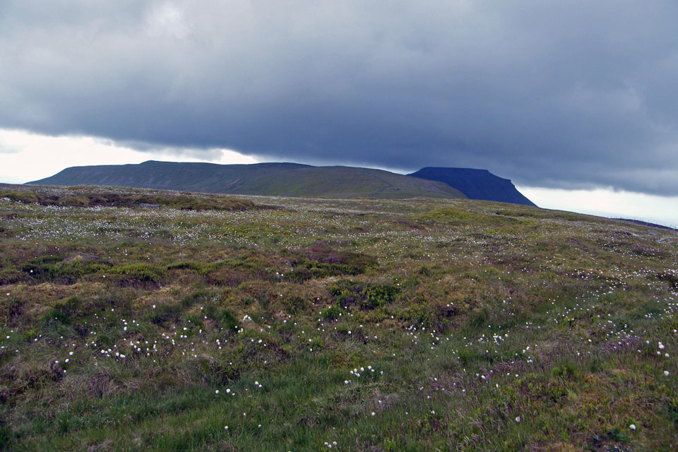
Park Fell, Souther Scales and Ingleborough

Eventually my path exited onto the road for a short walk back to the car

Ribblehead and a wet Whernside

And finally back to the car.
Next Walk: 19th June 2008 -- The Kendal Scars
Last Walk: 12th June 2008 -- Swaledale Meadows and Swinner Gill from Muker
We hope you have enjoyed viewing this walk. If you have any comments please sign our Guestbook or E_Mail us
